This item has been sold, but you can enter your email address to be notified if another example becomes available.


|
||

|

|
|

|
Stock# 90307
Description
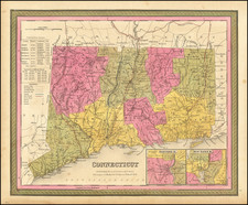
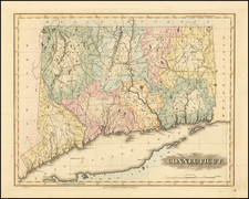
A detailed and attractive map of Connecticut, with inset plans of Hartford and New Haven.
The map is hand colored by county, showing roads, canals, towns, steamship routes and other interesting details. Includes early railroads, Courthouses, Churches, Taverns, etc.
A chart shows the County populations and other details.